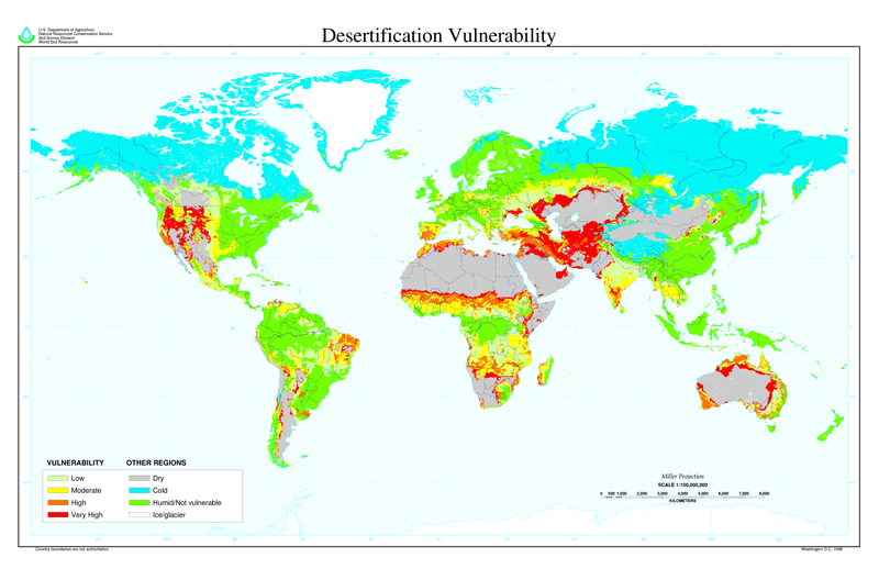
Ficheiro:Desertification map.png

Dimensões desta antevisão: 800 × 518 píxeis. Outras resoluções: 320 × 207 píxeis | 640 × 414 píxeis | 1 024 × 663 píxeis | 1 280 × 828 píxeis | 2 560 × 1 656 píxeis | 6 800 × 4 400 píxeis.
Imagem numa resolução maior (6 800 × 4 400 píxeis, tamanho: 1,04 MB, tipo MIME: image/png)
Histórico do ficheiro
Clique uma data e hora para ver o ficheiro tal como ele se encontrava nessa altura.
| Data e hora | Miniatura | Dimensões | Utilizador | Comentário | |
|---|---|---|---|---|---|
| atual | 11h01min de 27 de março de 2022 |  | 6 800 × 4 400 (1,04 MB) | No.cilepogača | Reverted to version as of 00:12, 8 November 2006 (UTC) |
| 05h11min de 8 de novembro de 2006 |  | 1 700 × 1 100 (558 kB) | Paleorthid | {{Information |Description=Global Desertification Vulnerability Map |Source=http://soils.usda.gov/use/worldsoils/mapindex/desert-map.zip |Date=1998 |Author=USDA employee |Permission=This image is a work of a United States Department of Agriculture employe | |
| 00h12min de 8 de novembro de 2006 |  | 6 800 × 4 400 (1,04 MB) | Paleorthid | {{Information |Description=Global Desertification Vulnerability Map |Source=http://soils.usda.gov/use/worldsoils/mapindex/desert-map.zip |Date=1998 |Author=USDA employee |Permission=This image is a work of a United States Department of Agriculture employe |
Utilização local do ficheiro
As seguintes 5 páginas usam este ficheiro:
Utilização global do ficheiro
As seguintes wikis usam este ficheiro:
- ar.wikipedia.org
- az.wikipedia.org
- bg.wikipedia.org
- bn.wikipedia.org
- bo.wikipedia.org
- ca.wikinews.org
- ckb.wikipedia.org
- cs.wikipedia.org
- da.wikipedia.org
- de.wikipedia.org
- de.wiktionary.org
- el.wikipedia.org
- en.wikipedia.org
- eo.wikipedia.org
- es.wikipedia.org
- eu.wikipedia.org
- fa.wikipedia.org
- fi.wikipedia.org
- fr.wikipedia.org
- fr.wikinews.org
- ga.wikipedia.org
- gl.wikipedia.org
- he.wikipedia.org
- hu.wikipedia.org
- hy.wikipedia.org
- id.wikipedia.org
- is.wikipedia.org
- it.wikipedia.org
- ja.wikipedia.org
Ver mais utilizações globais deste ficheiro.
