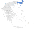
Ficheiro:Location map of Thrace (Greece).svg

Dimensões desta antevisão em PNG do ficheiro SVG: 693 × 599 píxeis Outras resoluções: 278 × 240 píxeis | 555 × 480 píxeis | 888 × 768 píxeis | 1 184 × 1 024 píxeis | 2 369 × 2 048 píxeis | 8 460 × 7 315 píxeis.
Imagem numa resolução maior (ficheiro SVG, de 8 460 × 7 315 píxeis, tamanho: 1,82 MB)
Histórico do ficheiro
Clique uma data e hora para ver o ficheiro tal como ele se encontrava nessa altura.
| Data e hora | Miniatura | Dimensões | Utilizador | Comentário | |
|---|---|---|---|---|---|
| atual | 15h43min de 17 de janeiro de 2015 |  | 8 460 × 7 315 (1,82 MB) | SilentResident | Fixed outline and color differences for some Greek islands in the Ionian Sea and the Aegean Sea that could confuse the readers. |
| 15h20min de 17 de janeiro de 2015 |  | 8 460 × 7 315 (1,82 MB) | SilentResident | The Map has been updated to include some missing territories of Greece. | |
| 19h43min de 16 de janeiro de 2015 |  | 7 304 × 7 315 (1,74 MB) | SilentResident | {{Information |Description ={{en|1=The location of Thrace within Greece.}} |Source ={{own}} |Author =SilentResident,Philly boy92 |Date =2014-01-16 |Permission = |other_versi... |
Utilização local do ficheiro
A seguinte página usa este ficheiro:
Utilização global do ficheiro
As seguintes wikis usam este ficheiro:
- ar.wikipedia.org
- bg.wikipedia.org
- el.wikipedia.org
- en.wikipedia.org
- fi.wikipedia.org
- id.wikipedia.org
- sr.wikipedia.org
- tr.wikipedia.org
- ur.wikipedia.org
- zh.wikipedia.org