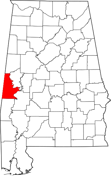
Ficheiro:Map of Alabama highlighting Sumter County.svg

Dimensões desta antevisão em PNG do ficheiro SVG: 379 × 599 píxeis Outras resoluções: 152 × 240 píxeis | 303 × 480 píxeis | 486 × 768 píxeis | 648 × 1 024 píxeis | 1 295 × 2 048 píxeis | 644 × 1 018 píxeis.
Imagem numa resolução maior (ficheiro SVG, de 644 × 1 018 píxeis, tamanho: 77 kB)
Histórico do ficheiro
Clique uma data e hora para ver o ficheiro tal como ele se encontrava nessa altura.
| Data e hora | Miniatura | Dimensões | Utilizador | Comentário | |
|---|---|---|---|---|---|
| atual | 13h08min de 25 de junho de 2024 |  | 644 × 1 018 (77 kB) | Nux | uniform colors with good contrast |
| 21h38min de 16 de junho de 2024 |  | 965 × 1 528 (77 kB) | Nux | fix rendering (remove clipping) | |
| 09h53min de 12 de fevereiro de 2006 |  | 3 379 × 5 346 (94 kB) | David Benbennick | {{subst:User:Dbenbenn/clm|county=Sumter County|state=Alabama}} |
Utilização local do ficheiro
As seguintes 3 páginas usam este ficheiro:
Utilização global do ficheiro
As seguintes wikis usam este ficheiro:
- ar.wikipedia.org
- az.wikipedia.org
- bg.wikipedia.org
- bpy.wikipedia.org
- ca.wikipedia.org
- cdo.wikipedia.org
- ceb.wikipedia.org
- ce.wikipedia.org
- cy.wikipedia.org
- de.wikipedia.org
- el.wikipedia.org
- en.wikipedia.org
- List of counties in Alabama
- Sumter County, Alabama
- Cuba, Alabama
- Emelle, Alabama
- Epes, Alabama
- Gainesville, Alabama
- Geiger, Alabama
- Livingston, Alabama
- York, Alabama
- Intercourse, Alabama
- National Register of Historic Places listings in Sumter County, Alabama
- Fort Tombecbe
- Template:Sumter County, Alabama
- User:Nyttend/County templates/AL
- Panola, Sumter County, Alabama
- Gainesville Historic District
- Category:Populated places in Sumter County, Alabama
- Bellamy, Alabama
- Ward, Alabama
- List of census-designated places in Alabama
- Template:NRHP in Sumter County, Alabama
Ver mais utilizações globais deste ficheiro.