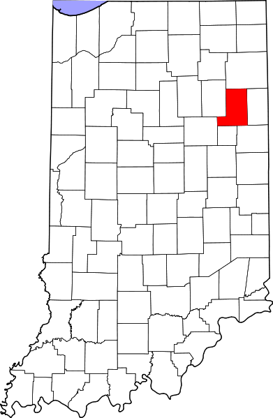
Ficheiro:Map of Indiana highlighting Wells County.svg

Dimensões desta antevisão em PNG do ficheiro SVG: 391 × 599 píxeis Outras resoluções: 156 × 240 píxeis | 313 × 480 píxeis | 501 × 768 píxeis | 668 × 1 024 píxeis | 1 337 × 2 048 píxeis | 722 × 1 106 píxeis.
Imagem numa resolução maior (ficheiro SVG, de 722 × 1 106 píxeis, tamanho: 42 kB)
Histórico do ficheiro
Clique uma data e hora para ver o ficheiro tal como ele se encontrava nessa altura.
| Data e hora | Miniatura | Dimensões | Utilizador | Comentário | |
|---|---|---|---|---|---|
| atual | 14h52min de 25 de junho de 2024 |  | 722 × 1 106 (42 kB) | Nux | uniform colors with good contrast |
| 20h43min de 19 de junho de 2024 |  | 722 × 1 106 (42 kB) | Nux | fix rendering (remove clipping) | |
| 12h12min de 12 de fevereiro de 2006 |  | 2 887 × 4 423 (56 kB) | David Benbennick | {{subst:User:Dbenbenn/clm|county=Wells County|state=Indiana}} |
Utilização local do ficheiro
A seguinte página usa este ficheiro:
Utilização global do ficheiro
As seguintes wikis usam este ficheiro:
- ar.wikipedia.org
- azb.wikipedia.org
- bg.wikipedia.org
- bpy.wikipedia.org
- cdo.wikipedia.org
- ceb.wikipedia.org
- ce.wikipedia.org
- cy.wikipedia.org
- de.wikipedia.org
- el.wikipedia.org
- en.wikipedia.org
- List of counties in Indiana
- Wells County, Indiana
- Zanesville, Indiana
- Markle, Indiana
- Bluffton, Indiana
- Ossian, Indiana
- Poneto, Indiana
- Uniondale, Indiana
- Vera Cruz, Indiana
- Ouabache State Park
- Template:Wells County, Indiana
- Chester Township, Wells County, Indiana
- Harrison Township, Wells County, Indiana
- Jackson Township, Wells County, Indiana
- Jefferson Township, Wells County, Indiana
- Lancaster Township, Wells County, Indiana
- Liberty Township, Wells County, Indiana
- Nottingham Township, Wells County, Indiana
- Rockcreek Township, Wells County, Indiana
- Union Township, Wells County, Indiana
- Craigville, Indiana
- Keystone, Indiana
- Kingsland, Indiana
- Liberty Center, Indiana
- Mount Zion, Indiana
Ver mais utilizações globais deste ficheiro.