Ficheiro:Monroe County (New York) - Towns, Villages, and City.svg

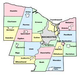
Dimensões desta antevisão em PNG do ficheiro SVG: 640 × 600 píxeis Outras resoluções: 256 × 240 píxeis | 819 × 768 píxeis | 1 092 × 1 024 píxeis | 2 185 × 2 048 píxeis | 1 500 × 1 406 píxeis.
Imagem numa resolução maior (ficheiro SVG, de 1 500 × 1 406 píxeis, tamanho: 73 kB)
|
|
Esta imagem provém do Wikimedia Commons, um acervo de conteúdo livre da Wikimedia Foundation que pode ser utilizado por outros projetos.
|
_-_Towns,_Villages,_and_City.svg)
Descrição do ficheiro
| Descrição |
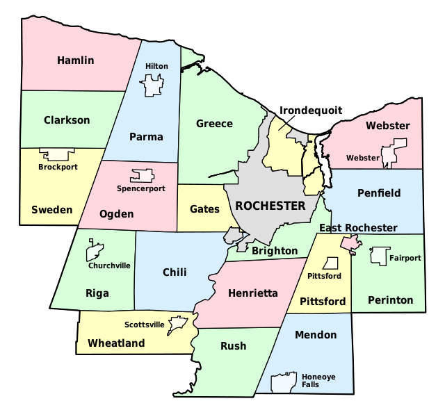
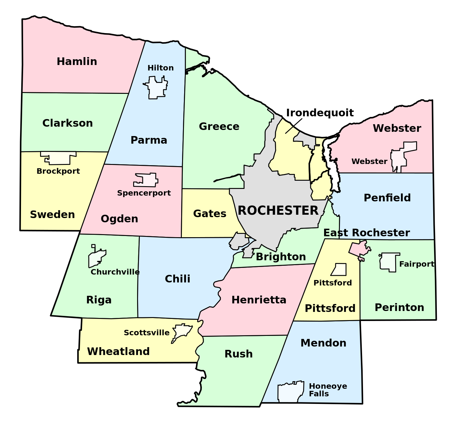
English: Map of Monroe County, New York, showing its constituent towns, villages, and city. Labels in English. |
| Data | |
| Origem | Own work by uploader, based on public domain USGS topographic maps |
| Autor | LtPowers |
Este(a) desenho vetorial não especificado foi criado com o Inkscape .
Licenciamento
Eu, titular dos direitos de autor desta obra, publico-a com a seguinte licença:
A utilização deste ficheiro é regulada nos termos da licença Creative Commons - Atribuição-CompartilhaIgual 3.0 Não Adaptada.
- Pode:
- partilhar – copiar, distribuir e transmitir a obra
- recombinar – criar obras derivadas
- De acordo com as seguintes condições:
- atribuição – Tem de fazer a devida atribuição da autoria, fornecer uma hiperligação para a licença e indicar se foram feitas alterações. Pode fazê-lo de qualquer forma razoável, mas não de forma a sugerir que o licenciador o apoia ou subscreve o seu uso da obra.
- partilha nos termos da mesma licença – Se remisturar, transformar ou ampliar o conteúdo, tem de distribuir as suas contribuições com a mesma licença ou uma licença compatível com a original.
Histórico do ficheiro
Clique uma data e hora para ver o ficheiro tal como ele se encontrava nessa altura.
| Data e hora | Miniatura | Dimensões | Utilizador | Comentário | |
|---|---|---|---|---|---|
| atual | 16h58min de 30 de novembro de 2008 | | 1 500 × 1 406 (73 kB) | LtPowers | {{Information |Description={{en|1=Map of Monroe County, New York, showing its constituent towns, villages, and city. Labels in English.}} |Source=Own work by uploader, based on public domain USGS topographic maps |Author=[[U |
Utilização local do ficheiro
A seguinte página usa este ficheiro:
Utilização global do ficheiro
As seguintes wikis usam este ficheiro:
- en.wikipedia.org
- Monroe County, New York
- Irondequoit Bay State Marine Park
- Honeoye Creek
- University of Rochester Arboretum
- North Chili, New York
- Genesee Junction, New York
- Maplewood Park
- Gates Center, New York
- Cobbs Hill Reservoir
- Irondequoit Gully
- Black Creek Park
- Hart's Woods
- Template:MonroeCountyNY-geo-stub
- Adams Basin, New York
- Black Creek (Genesee River tributary)
- High Falls (Rochester, New York)
- Gates (CDP), New York
- Hamlin (CDP), New York
- Clarkson (CDP), New York
- Union Hill, New York
- North Greece, New York
- es.wikipedia.org
- fr.wikipedia.org
- ja.wikipedia.org
- la.wikipedia.org
- www.wikidata.org
_-_Towns,_Villages,_and_City.svg)