Ficheiro:NCyprus districts named.png

Sem resolução maior disponível.
NCyprus_districts_named.png (600 × 365 píxeis, tamanho: 47 kB, tipo MIME: image/png)
|
|
Esta imagem provém do Wikimedia Commons, um acervo de conteúdo livre da Wikimedia Foundation que pode ser utilizado por outros projetos.
|
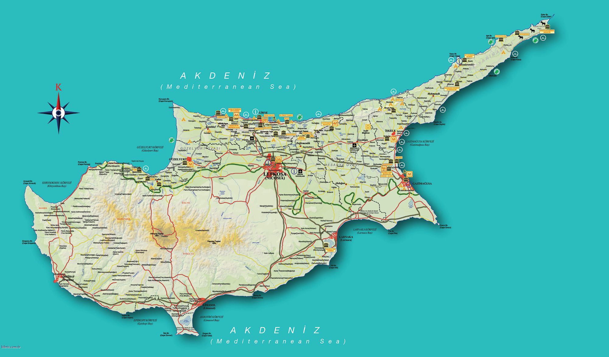
| Descrição | Map of the districts of Cyprus, with English annotations, and showing the Turkish Republic of Northern Cyprus, United Kingdom Sovereign Base Areas, and United Nations buffer zone. The TRNC section illustrates the current de facto district boundaries following this map as a guide. The northern districts are labelled in Turkish. | |||
| Data | (UTC) | |||
| Origem | ||||
| Autor |
|
|||
| Outras versões |
|


Eu, titular dos direitos de autor desta obra, publico-a com as seguintes licenças:
A utilização deste ficheiro é regulada nos termos da licença Creative Commons - Atribuição-CompartilhaIgual 2.5 Genérica, 2.0 Genérica e 1.0 Genérica.
- Pode:
- partilhar – copiar, distribuir e transmitir a obra
- recombinar – criar obras derivadas
- De acordo com as seguintes condições:
- atribuição – Tem de fazer a devida atribuição da autoria, fornecer uma hiperligação para a licença e indicar se foram feitas alterações. Pode fazê-lo de qualquer forma razoável, mas não de forma a sugerir que o licenciador o apoia ou subscreve o seu uso da obra.
- partilha nos termos da mesma licença – Se remisturar, transformar ou ampliar o conteúdo, tem de distribuir as suas contribuições com a mesma licença ou uma licença compatível com a original.

|
É concedida permissão para copiar, distribuir e/ou modificar este documento nos termos da Licença de Documentação Livre GNU, versão 1.2 ou qualquer versão posterior publicada pela Free Software Foundation; sem Secções Invariantes, sem textos de Capa e sem textos de Contra-Capa. É incluída uma cópia da licença na secção intitulada GNU Free Documentation License. |
| A utilização deste ficheiro é regulada nos termos da licença Creative Commons - Atribuição-CompartilhaIgual 3.0 Não Adaptada. | ||
| ||
| Esta marca de licenciamento foi adicionada a este ficheiro durante a atualização da licença GFDL. |
Pode escolher a licença que quiser.
Registo de carregamento original
This image is a derivative work of the following images:
- Image:Cyprus_districts_named.png licensed with Cc-by-sa-2.5,2.0,1.0, GFDL
- 2007-08-13T14:28:15Z Lexicon 600x365 (22511 Bytes) Reverted to earlier revision
- 2007-08-13T14:28:03Z Lexicon 600x365 (55202 Bytes) buffer zone and SBA colours flipped, since buffer zone is called the "Green Line"
- 2005-06-30T06:07:58Z Golbez 600x365 (22511 Bytes) Got Dhekelia wrong again. Final version unless others have comments.
- 2005-06-28T02:04:32Z Golbez 600x365 (22795 Bytes) Updated again, final version for now, cleaned up text and the Dhekelia area.
- 2005-06-27T17:51:02Z Golbez 600x365 (20527 Bytes) Fixed a color
- 2005-06-27T17:44:36Z Golbez 600x365 (20529 Bytes) Updated map with different color for north and south, and enclaves in Dhekelia.
- 2005-06-27T09:48:54Z Golbez 600x365 (19121 Bytes) Map of the districts of [[Cyprus]] Source: Made by [[User:Golbez]]. {{cc-by-sa-2.0}} [[Category:Maps of Cyprus]]\
Carregada com derivativeFX
Histórico do ficheiro
Clique uma data e hora para ver o ficheiro tal como ele se encontrava nessa altura.
| Data e hora | Miniatura | Dimensões | Utilizador | Comentário | |
|---|---|---|---|---|---|
| atual | 13h34min de 18 de setembro de 2008 | | 600 × 365 (47 kB) | QuartierLatin1968 | {{Information |Description=Map of the districts of Cyprus, with English annotations, and showing the Turkish Republic of Northern Cyprus, United Kingdom Sovereign Base Areas, and United Nations buffer zone. The TRNC section illustrates the current ''de fa |
Utilização local do ficheiro
A seguinte página usa este ficheiro:
Utilização global do ficheiro
As seguintes wikis usam este ficheiro:
- am.wikipedia.org
- ar.wikipedia.org
- arz.wikipedia.org
- ba.wikipedia.org
- be.wikipedia.org
- bg.wikipedia.org
- de.wikipedia.org
- el.wikipedia.org
- en.wikipedia.org
- fr.wikipedia.org
- gl.wikipedia.org
- it.wikivoyage.org
- la.wikipedia.org
- mk.wikipedia.org
- mrj.wikipedia.org
- ru.wikipedia.org
- sc.wikipedia.org
- simple.wikipedia.org
- sk.wikipedia.org
- sr.wikipedia.org
- sv.wikipedia.org
- tg.wikipedia.org
- tr.wikipedia.org
- uk.wikipedia.org
- vi.wikipedia.org
- zh.wikipedia.org