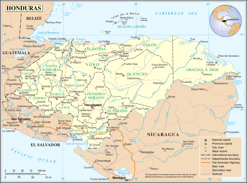
Ficheiro:Un-honduras.png

Dimensões desta antevisão: 800 × 594 píxeis. Outras resoluções: 320 × 238 píxeis | 640 × 475 píxeis | 1 024 × 760 píxeis | 1 280 × 950 píxeis | 2 560 × 1 901 píxeis | 3 277 × 2 433 píxeis.
Imagem numa resolução maior (3 277 × 2 433 píxeis, tamanho: 1,92 MB, tipo MIME: image/png)
Histórico do ficheiro
Clique uma data e hora para ver o ficheiro tal como ele se encontrava nessa altura.
| Data e hora | Miniatura | Dimensões | Utilizador | Comentário | |
|---|---|---|---|---|---|
| atual | 01h11min de 24 de outubro de 2007 |  | 3 277 × 2 433 (1,92 MB) | Jeroen | {{UN map}} Category:Maps of Honduras |
Utilização local do ficheiro
As seguintes 3 páginas usam este ficheiro:
Utilização global do ficheiro
As seguintes wikis usam este ficheiro:
- af.wikipedia.org
- arz.wikipedia.org
- ast.wikipedia.org
- bs.wikipedia.org
- en.wikipedia.org
- es.wikipedia.org
- fa.wikipedia.org
- fi.wikipedia.org
- fr.wikipedia.org
- gom.wikipedia.org
- id.wikipedia.org
- mk.wikipedia.org
- mt.wikipedia.org
- nl.wikipedia.org
- nn.wikipedia.org
- pl.wiktionary.org
- sl.wikipedia.org
- uk.wikipedia.org
